


The dynamic behaviour of inland vessels on natural waterways is determined in particular by the hydrodynamic boundary conditions, i.e. flow velocity, water depth and river cross-section, as well as by the position of the lane with regard to the hydraulic structure (groynes, guide structures and bank protections). In addition, traffic regulations, partly depending on the water levels, e.g. the maximum ship speed, as well as the encounter of larger ships in narrower curve sections. Therefore, in this work package 4200 all necessary infrastructure data for the demonstration areas defined in WP 2000 (Lower, Middle and Upper Rhine as well as West German canal grid) shall be provided. Infrastructure data includes static and dynamic waterway data, hydraulic structure data, and traffic regulations:
Flow data are generated using two-dimensional depth-averaged hydrodynamic numerical models (2D-HN models) for a range navigable water levels (steady-state discharge). The results of the modelling are made available on a BAW-server, which interpolates the instantaneous flow velocities and water depths in the ship’s path depending on the respective current water level, which is read out e.g. via PEGELONLINE or ELWIS, and also provides the other waterway and hydraulic structure data as well as traffic regulations.
The waterway and hydraulic structure data listed here will be filtered and compiled for the demonstration areas. For this purpose, it is necessary to update the existing flow models, to adapt them to the currently available hydrographic data and to create new flow models in waterway sections for which no models exist in the BAW so far. In the free-flowing waterway sections (e.g. Lower, Middle and Upper Rhine), the 2D hydrodynamic numerical flow models are applied to a narrow range of discharges between Low Water Level (NW) and Highest Navigable Water Level (HSW). All data will be made available in an appropriate data format on the BAW-database server for online public access.
The goal is for a remotely operated and partially automated barge to be able to access the BAW- server via cellular radio and retrieve either the water level data for a river section or selectively at a location. With online access to the current and predicted gauge in a waterway section, the BAW-database server generates a data set for this query that contains the requested waterway and hydraulic structure data, with the flow data (water depth and flow velocities) being interpolated from the previously modelled discharge ranges. Here, depending on the type of query, predicted water levels can also be used, for example, in the context of further route planning. Although route planning is not yet envisaged in the present project proposal, it will be indispensable in subsequent projects, e.g. the project on energy-efficient driving. These data are available to the other work packages and are required by the applications developed there for the dynamic driving prognosis of the own ship and the foreign ships.
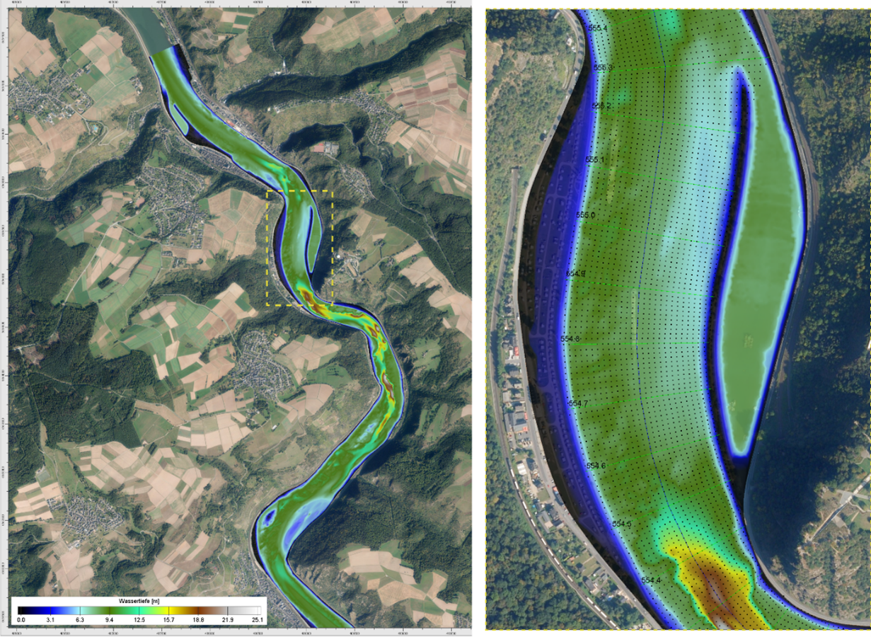
Figure 1: Example of a section of 2D flow model of Middle Rhine (left) and the flow axis-oriented grid (black) for the interpolation of the flow data (right) aerial photograph of – Geobasisdaten: © GeoBasis-DE / BKG (2022)